 |
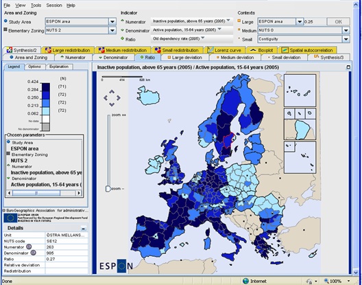
HyperAtlas V2 is a multiscalar territorial analysis tool. This new version embeds powerful spatial analysis and statistics methods, and enlightens deviations and differences between European territorial units at various levels of division. Read more |

|
HyperAtlas V2 is a multiscalar territorial analysis tool. This new version embeds powerful spatial analysis and statistics methods, and enlightens deviations and differences between European territorial units at various levels of division. Read more |